The History of the Area
5 Million Years to Present Time
Geological Timelines
5 Million to 1 Million Years Before Present Time
From 5 million years ago, Bottle Bend began to emerge as the sea receded. Being a much warmer time, the sea level was 100 metres higher than currently, and the potential for it to rise again in the next 100 years will be determined by the impact of climate change.
1 Million to 60,000 Years Before Present Time
With the sea level continuing to lower, the Murray River was blocked from flowing to the sea near the present day South Australian border. This was caused by an uplift of the Pinnaroo block. With this blocking, along with an intense wet period, the Lake Bungunnia freshwater lake was formed. This lake survived for thousands of years because of a thick clay layer allowing separation between the saline groundwater in the Parilla sand layer. This occurred due to the remnant sea and the sand layer deposited that later formed our current day landscape.
60,000 to 20,000 Years Before Present Time
With the Murray River breaching through the Pinnaroo uplift, the flow recommenced to the ocean and for the next 40,000 years the environment was suitable for all forms of life, including humans. (see Mungo man story)
20,000 to 10,000 Years Before Present Time
The Ice Age commenced around this time when the sea level was at its lowest, with the water reduced in volume through the large frozen areas. Anything not frozen at this stage was reduced to dry landscapes and the wind and dry periods of the next 10,000 years formed our current day sandy, loam landscapes.
10,000 to Present Time
Our landscapes today have continued to become more arid, forming the Mallee landscapes, with a fine balance of interaction between saline groundwater aquifers and waterways. Here at Bottle Bend this is highlighted with the saline wetland creating acid sulphate conditions when the water level drops. As part of the ongoing management to maintain good water coverage of the wetland, there is a direct connection to our 5 million years old shoreline.
Geological and Hydrogeological Values
The Bottle Bend Lagoon has some unusual combinations of features for the lower floodplain of the Murray River. Bottle Bend Lagoon is up to 2 metres deeper than nearby billabongs. The base of the lagoon is below stranded silcrete that occurs on the edge of the lagoon. The lagoon is intruded by ancient, highly saline acidic groundwater, from deep aquifers low in oxygen that become more acidic when exposed to the atmosphere.
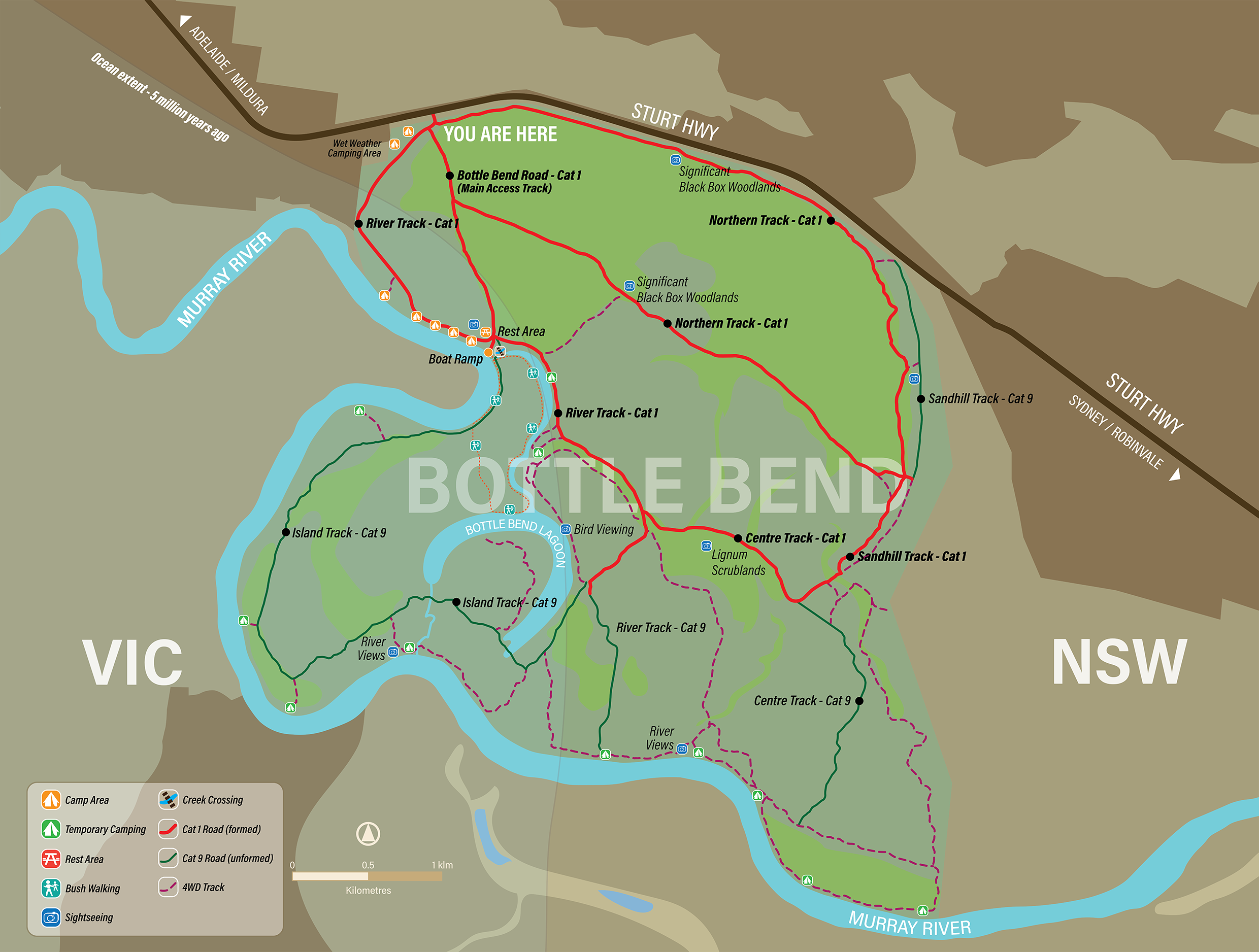
Present Day - Reserve Map
Fireplace
There is evidence of Aboriginal occupation, with many fireplaces and other culturally significant sites scattered all around the reserve. It is important not to disturb or remove any of the objects or artefacts. (Kureinji country)
Scar Tree
There are a number of scar and canoe trees in the reserve which many are hundreds of years old. (Kureinji country)
.


